El Camino Healthcare District Boundaries Map data provided by the Department of Planning and Development, County of Santa Clara.
Steps to Look Up an Address
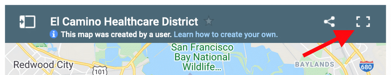
Step 1
Expand the map above by selecting the view larger map icon in the upper right corner.
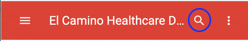
Step 2
Select the magnifying glass located on the left-hand-side of the page.
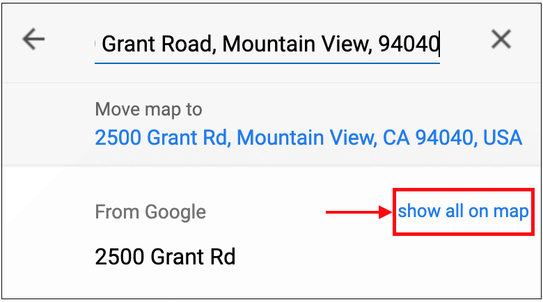
Step 3
Enter the address and select "show all on map" link.
Legal Disclaimer
ECHD Boundary Map data was provided by the Santa Clara County Department of Planning and Development. The map is to be used for informational purposes only and is subject to change without notice. El Camino Health and El Camino Healthcare District make no warranties or guarantees regarding the accuracy of the data or the map.